Living in the UK, a downpour never comes as much of a surprise.
But every now and then, it helps to have an idea of what to expect when you set foot outside so that you can plan what to wear, what to do and how to stay safe.
A weather forecast will not only tell you where and when the weatherās going to change, but why.
Typically, itās the āwhyā bit of the forecast where people tend to get confused. It can all get a bit scientific, with references to air pressure and weather fronts.
If you want to sound like a total expert next time you're watching a weather forecast, here's a guide to understanding the science behind one.
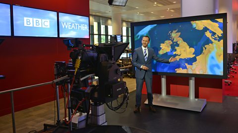 Image source, “óĻó“«Ć½
It all comes down to pressure
Often in a weather forecast, the presenter will refer to high and low pressure. There may even be areas marked with āHIGHā and āLOWā on the weather map.
But what does this mean?
In this case, pressure is actually short for atmospheric pressure.
The atmosphere is the layer of air that wraps all around the Earth. When molecules within the air collide with a surface, that creates pressure.
Atmospheric pressure decreases the higher you go, because the number of air molecules decreases, and they weigh less (there is a weaker gravitational pull).
On a weather map, points with similar levels of atmospheric pressure are connected together with lines, known as isobars.
Sometimes, these lines will be labelled by a number. This is a measure of the pressure, in millibars . The lower the number, the lower the pressure.
Highs and lows
Atmospheric pressure doesnāt only change with height, it also varies across the surface of the Earth.
We get our heat from the Sun, however this heat is not spread evenly across the Earth. The areas around the Equator are much warmer than the polar regions, because they receive more heat.
But Equatorial regions donāt keep getting hotter and hotter and the poles donāt get colder and colder. The heat we receive gets spread around the atmosphere by the movement of air ā what we call wind.
As the air around the Equator warms, it rises up through the atmosphere and then heads towards the poles, where it starts to sink back towards the Earthās surface and then back towards the Equator. This large-scale movement of air helps transfer some of the heat from the Equator towards the poles.
At the Earthās surface, an area of low pressure forms where the air is rising, and high pressure where the air is sinking. Wind blows from the area of high pressure to the area of low pressure to try to equalise the difference in atmospheric pressure.
But itās not quite that simple. Because the Earth is spinning, the air doesnāt travel in a straight line. It rotates out of an area of high pressure and into an area of low pressure. This is why, when you see a satellite image of Earth in a forecast, it appears clouds are being blown into spirals by the wind.
But how does pressure effect the weather?
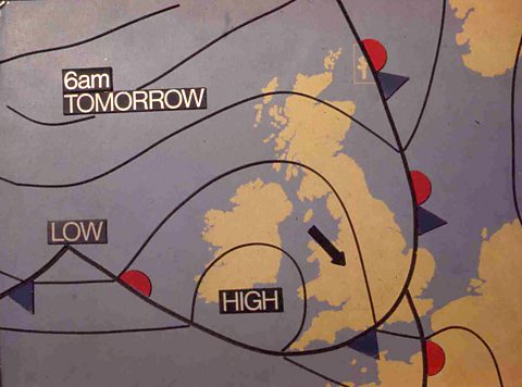 Image source, “óĻó“«Ć½
The benefits of a high pressure situation
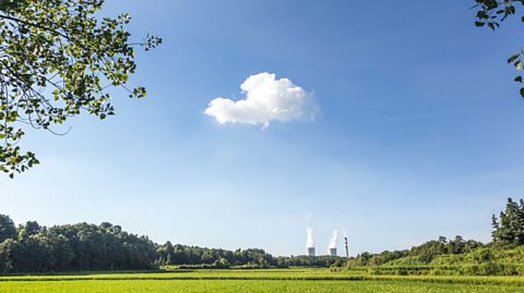
If youāre hoping for a lovely sunny day, whatever the season, youāll want to keep your fingers crossed for an area of high pressure (also called an anticyclone).
During a period of high pressure, the air is descending. This means that water vapour in the air canāt rise upwards and condense into droplets to form clouds and rain, so the weather is typically quite dry with clear skies and only light winds.
However, without clouds acting as a barrier to heat, there can be a sharp difference in temperature between daytime and night-time, like those experienced in deserts.
Clear summer skies provide the perfect opportunity for a spot of stargazing and your local “óĻó“«Ć½ weather forecast will highlight any special events, but remember to wrap up warm. Temperatures will drop a lot quicker than you might expect.
Image source, “óĻó“«Ć½Blame it on the low pressure
Low pressure systems, sometimes called depressions, tend to bring wetter, windier weather.
As the air in an area of low pressure is ascending into colder parts of our atmosphere, water vapour condenses to form water droplets, which then form clouds. As the droplets grow, they sometimes fall back to the surface as rain, snow or hail.
Whilst the cloudier skies keep temperatures cooler by blocking out the Sun, they also help to trap the heat that makes it through. As a result, the difference between daytime and night-time temperatures isnāt as significant.
Itās all change at a weather front
Have you ever wondered what the lines with blue triangles and red semicircles are there for in a weather forecast?
These lines symbolise weather fronts, and the triangles or semicircles point in the direction the front is moving.
A weather front marks the boundary between a large area of warmer air and one of colder air. It can also mark a large change in the amount of moisture held in the air.
We usually refer to these areas of air which share similar characteristics as āair massesā. So, the weather front marks the boundary between two air masses.
To explain more, hereās former “óĻó“«Ć½ weather presenter and drumming legend, Owain Wyn Evans.
At a warm front, warm, moist air rises over the denser cold air.
As it rises, the air cools. Water vapour condenses into water droplets to form clouds, which can extend many miles in front of the cold front.
As the warm front approaches, the clouds can get thicker, and rain can start to fall. The air that follows the front will be warmer than the air mass it is replacing.
At a cold front, the denser cold air gradually moves below an area of warm air that it is following. As the warm air is pushed up the water vapour condenses, a narrow band of thick, heavy clouds can form and it can begin to rain heavily. Sometimes there might even be thunderstorms.
Spotting when itās about to blow a gale
Wind is simply the name we give to the movement of air between high and low pressure areas.
In “óĻó“«Ć½ weather forecasts, wind speed and direction are represented by wind arrows. The number in the circle represents the average wind speed as miles per hour, and the arrow points in the direction the wind is blowing.
Normally, these wind arrows are coloured white.
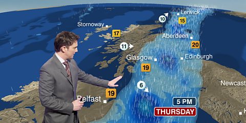 Image source, “óĻó“«Ć½
However, you might have noticed that they occasionally turn to black. This is an indication that there could be gusts of wind of over 40mph.
When this happens, you should take extra precautions when heading outside. An umbrella might not be the best choice, for starters.
What direction the wind is coming from might seem like unnecessary information for a weather forecast, but it can have a dramatic impact on the weather.
Northerly winds in the UK (blowing from north to south) come from the Arctic region and tend to be colder. As this cold air moves over a warming sea, clouds form and the chances of rain increase.
In contrast, winds from the south and southeast tend to bring warmer and drier weather, with the occasional thunderstorm.
Test your knowledge by tuning into a “óĻó“«Ć½ weather forecast today, and see how many symbols and terms you can spot.
This article was published in August 2020 and updated in July 2024
Hair ice? Ice pancakes? Diamond dust? Here's the science behind these magical ice phenomena.
How much do you really know about climate change?
We are always hearing about it in the news, but have you been paying attention?
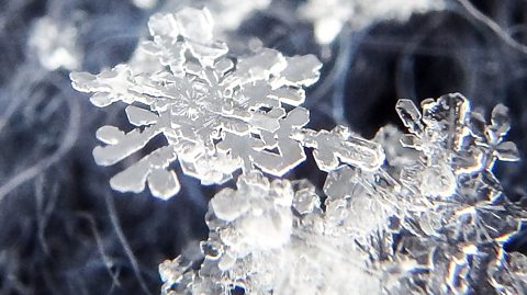
Why are all snowflakes unique?
The science behind making every drop of snow different.