Using aerial photographs
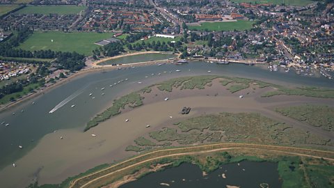
Aerial photos can be used to help identify river features. For example, geographers might be able to view the different courses, or they might be able to identify some of the main features and landforms such as waterfalls, levees, or meanders.
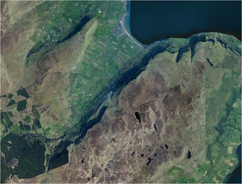
The image shows the river valley at the mouth of the Glenariff river. The meandering path of the river can just about be seen across the flat green section in the middle of the photograph.
The flat river flood plain is very obvious as is the high land that surrounds the river valley. Higher land in the Antrim hills will often have less vegetation and be a brown colour. The dark green areas towards the bottom left of the map indicate some planted forest.
It is possible that you might have to identify river features directly from an aerial photo or a satellite image but it is more likely that you will have to match this up with what you can see on an Ordnance Survey map.
Using OS maps to identify river features
Maps help geographers to plot the course that rivers run from their source to the mouth. Sometimes it can be very difficult to plot the exact start of a river in the hills and mountains and most rivers will have a range of tributaries where the river starts.
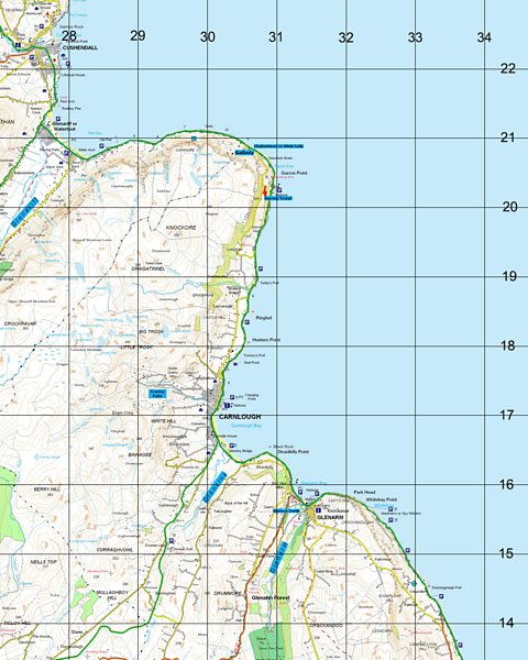
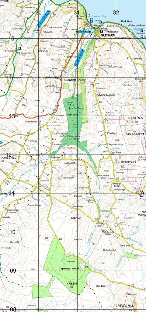
This map shows the mouth of a number of rivers as they flow off the Antrim Hills and into the North Channel ÔÇô the Glenariff, Glencloy and Glenarm. In each case this shows the lower course of the river as it makes its final journey through the mouth and into the sea.
Each of the rivers has a very different path towards their mouth.
The Glencloy river is a very narrow river that is still meandering at the bottom of some steep land before it meets the sea.
The Glenariff river is also not a very wide river as it moves north out of the Forest Park and spreads over a flat flood plain before taking a left turn around the back of the village of Waterfoot.
The Glenarm river is a much wider river (up to 17m in some parts) and goes through the Glenarm Forest/ Great Deer Park and eventually flows into Glenarm Bay.
Sometimes, the map shows evidence of different erosion features (like waterfalls and river meanders) and usually in the lower course deposition features such as levees and even river islands can be noted.
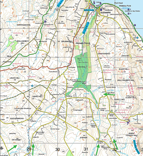
It is always much more difficult to trace the start of the river at the source. There are usually a number of different sources where different tributaries will begin their journey towards the mouth.
For example ÔÇô The Glenarm river starts across a range of places including the Loughdull Burn, Clady Burn, Ballytober water, Mullaghsandall Burn, Skeagh water, Capanagh Water, Wolf Water, Shillnovogy water and Owencloghy water.
For more general revision of map skills go to the Map skills section in Geographical skills.
Test yourself
More on River environments
Find out more by working through a topic
- count5 of 5
- count1 of 5
- count2 of 5
- count3 of 5
