'Unusual' Greenland wildfires linked to peat
- Published

Smouldering fires in Greenland are believed to be burning peat
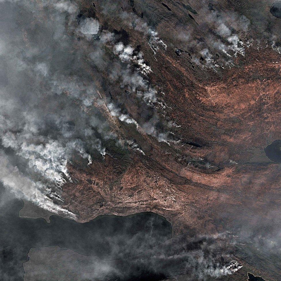
New images have been released of wildfires that continue to burn close to the Greenland ice sheet, on the country's west coast.
Fires are rare on an island where 80% of the land is covered by ice up to 3km thick in places.
However, satellites have observed smoke and flames north-east of a town called Sisimiut since 31 July.
Experts believe at least two fires are burning in peat that may have dried out as temperatures have risen.
A song of fire and ice?
Researchers say that across Greenland there is now less surface water than in the past, which could be making vegetation more susceptible to fire.
The fire was first spotted at the end of July
The latest satellite images show a number of plumes. Police have warned hikers and tourists to stay away from the region because of the dangers posed by smoke. There are also concerns that the fire will damage grazing for reindeer.
Scientists believe that instead of shrubs or mosses, the likely source is fire in the peaty soil, which can only burn when dry.
"Usually when a wildfire is smouldering like that it's because there's a lot of ground-level fuel, carbon organic matter; that's why I assume that it's peat," wildfire expert Prof Jessica McCarty from Miami University, US, told 大象传媒 News.
"The fire line is not moving, the fire is not progressing like we'd see in a forest fire, so that means it's burning whatever fuel is on the ground."
Prof McCarthy believes that melting permafrost is likely to have contributed to this outbreak. She referred to that showed degraded permafrost around the town of Sisimiut.
Locals say that what they call "soil fires" have happened before, especially in the last 20-30 years.
The fires are in a region close to the town of Sisimiut
Researchers have been busily examining the satellite record to look for evidence of previous outbreaks.
"The only record I found is the . It's a satellite that measures the temperature of the surface and can locate hotspots from fire," said Dr Stef Lhermitte from Delft University in the Netherlands.
"I think that fires have been there before but what's different is that this fire is big, in Greenlandic terms; that is unusual. It's the biggest one we have in the satellite record."
Dr Lhermitte's analysis suggest that the satellite has detected more fires in 2017 alone in Greenland than in the 15 years it has been operating. A previous large outbreak was seen in 2015.
Emissions of CO2 following fires in Greenland show a big spike this year
One key question about these fires is the the influence of a changing climate.
"This peat is less than 70km from the ice sheet. It's a little difficult to believe that it would be degraded already without increasing melting and higher temperatures," said Prof McCarty.
"But as a scientist we can't say it's definitely climate change until we've done the analysis after the fire."
Peat fires worry researchers because the material stores large amounts of CO2 that is released through burning. They are also worried that the "black carbon" soot arising from the fires could land on the ice sheet and cause further melting.
Some rain is expected tomorrow which researchers hope will put the fire out.
Prof McCarty added: "I work a lot in this field and no-one has ever thought of doing a fire study in Greenland, I can tell you!"
Follow Matt on and on .