Historic England pictures show Nottingham through the decades
- Published

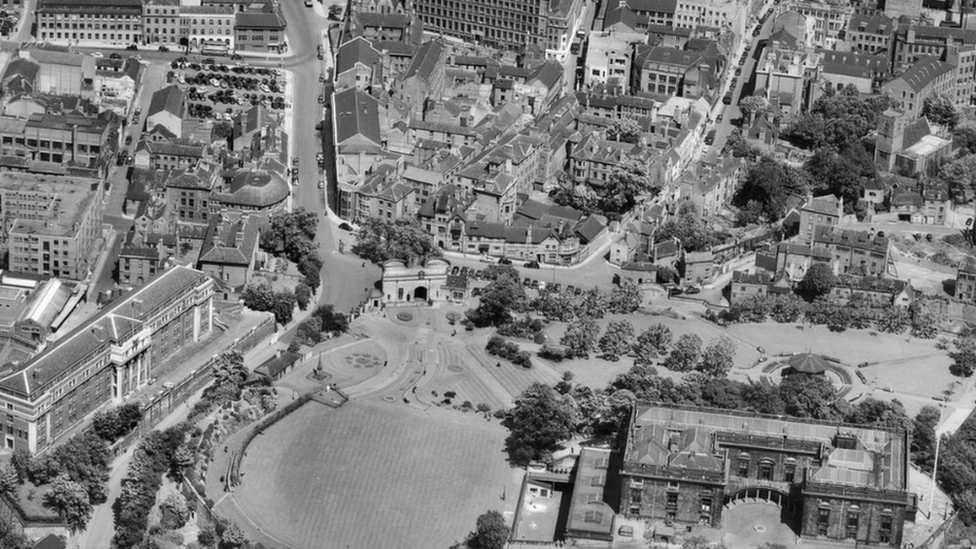
A picture of Nottingham Castle from the 1950s, before the construction of Maid Marian Way
Newly-released photographs from Historic England show Nottingham through the decades.
English Heritage's allows users to search and explore an online map showing aerial photographs of England taken over the past 100 years.
Boats row along the River Trent past the City Ground
This photograph, from 1933, shows Nottingham Forest's football ground and the Turney Bros leather works, sitting alongside the River Trent.
The ground backs on to fields but is now an established part of the city centre.
Nottingham's Council House is still being built, while parts of the city's Victoria Railway Station can also be seen
This photograph, from 1928, shows Nottingham's Council House still under construction, its dome covered in scaffolding.
Work on it would finish in 1929. In front of it are lines of market stalls.
Further north in Nottinghamshire, former pupils will have memories of Mansfield's former grammar school - Queen Elizabeth's, pictured here in 1950.
The school became an academy in 2012.
The old grammar school in Mansfield is now an academy
More than 400,000 images from 1919 to the present day have been added to the tool, covering nearly 30% (c.15,000 square miles) of England, allowing people immediate digital access to Historic England's nationally important collection of aerial photographs.
Duncan Wilson, chief executive of Historic England said: "I am delighted that our new online tool will allow people to access easily our wonderful collection of aerial images and enjoy the historic photography that our team uses every day to unlock the mysteries of England's past."
Matthew Oakey, interim national aerial investigation and mapping manager, said: "Around 300,000 of the photographs were taken by Historic England's own flying programme. We have aerial archaeologists flying throughout the year, photographing landscapes both urban and rural and recording and discovering new archaeological sites.
"A large number of photographs were taken by the RAF during and after World War Two for surveying and planning purposes. We also have a number of photographs taken by a company called Aerofilms Ltd, which mostly span the period from the 1920s to the 1960s and provide a fascinating snapshot of the interwar years."
Follow ґуПуґ«ГЅ East Midlands on , , or . Send your story ideas to eastmidsnews@bbc.co.uk.