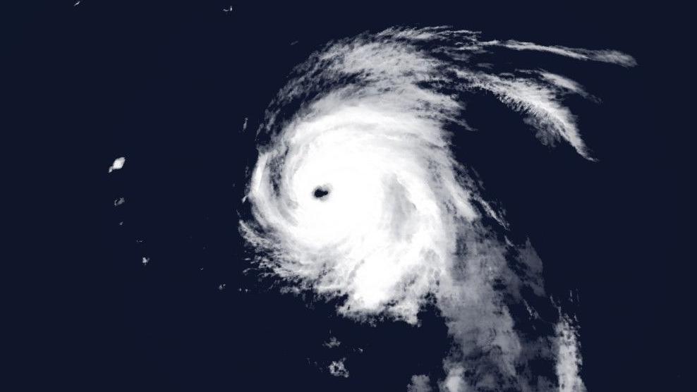
Hurricane Kirk: How could it affect the UK's weather?

Hurricane force winds extend out 35 miles (56km) from Kirk's eye
- Published
Hurricane Kirk, a major category 4 storm, is currently 3,000 miles (4,820 km) away in the mid-Atlantic, but its remnants may bring disruptive weather to the UK next week.
Kirk is currently producing winds of 145mph (233 km/h).
It will remain a major hurricane over open waters for the next few days, but is likely to make a turn to the north-east and could influence UK weather by the middle of next week.
However, there is considerable uncertainty at this stage on details and timings, but parts of England and Wales could experience spells of heavy rain and strong winds.
The official track from the National Hurricane Center shows Kirk's expected path for the next five days, with a cone highlighting the uncertainty in possible position
What will happen to Kirk next?
As Kirk moves north out of the tropics, it will eventually weaken over the cooler waters further north.
If conditions are right, the remnants of Kirk may get swept towards north-west Europe, no longer as a hurricane but a deep depression capable of producing strong winds and intense rainfall.
However, computer models that generate weather forecast data often struggle to process details when dealing with hurricanes. This is due to the extra uncertainty created by vast quantities of tropical moisture and energy.
This means confidence in the forecast with regards to the behaviour of the remnants of Hurricane Kirk is currently fairly low. Different computer models continue to indicate very different timings and possible impacts of the storm over the next week or so.
Left image: European ECMWF model forecast. Right image: American GFS model forecast
What could the potential impacts be for the UK?
Weather forecasters will be keeping a close eye on the behaviour of Hurricane Kirk over the coming days to see if and how it starts to interact with our jet stream and with other areas of low pressure in the North Atlantic.
If the storm's remnants do head towards the UK, the impacts will vary hugely depending on its location, pressure and timing.
If the storm moves to our north, it may drag up some humid, tropical air and push our temperatures upwards. If the system tracks to our south, a colder spell of weather is possible, with the chance of blustery showers.
But if the storm tracks right across the UK, there is the potential for a spell of particularly wet, windy and possibly disruptive weather.
Keep up to date with our latest forecast and any warnings that may get issued nearer the time.
Our latest thoughts on the longer-range
- Published19 hours ago
How hurricanes can impact UK weather