Different types of depositional landforms
Floodplains
A floodplainAn area of low-lying land next to a river which is prone to flooding. is an area of land which is covered in water when the river bursts its banks.
They form due to both erosion and depositionWhen material is deposited or left behind, eg when a river loses its energy and is unable to carry its load any further, or waves move sand onto a beach but lack the energy to carry it away.. erosionThe wearing away of pieces of rock, soil or other solid materials. removes any interlocking spurHill that a river meanders around in a V-shaped valley. When viewed from downstream, these spurs appear to be locked together., creating a wide, flat area on either side of the river. During a flood, material being carried by the river is deposited (as the river loses its speed and energy to transport material). Over time, the height of the floodplain increases as material is deposited on either side of the river.
Floodplains are often agricultural land, as the area is very fertile because it's made up of alluviumThe sediment deposited by rivers. Also known as silt. (deposited silt from a river flood). The floodplain is often a wide, flat area caused by meanderA bend in a river. shifting along the valley.
Levees
- Levees occur in the lower courseThe final section of a river located on flat land. of a river when there is an increase in the volume of water flowing downstream and flooding occurs.
- Sediment that has been eroded further upstream is transported downstream.
- When the river floods, the sediment spreads out across the floodplain.
- When a flood occurs, the river loses energy. The largest material is deposited first on the sides of the river banks and smaller material further away.
- After many floods, the sediment builds up to increase the height of the river banks, meaning that the channel can carry more water (a greater dischargeThe volume of water in a river passing a point in a given time. Measured in cumecs (cubic metres per second).) and flooding is less likely to occur in the future.
Estuaries
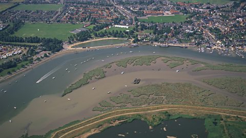
An estuaryThe open mouth of the river where it meets the sea. is where the river meets the sea. The river here is tidal and when the sea retreats the volume of the water in the estuary is reduced. When there is less water, the river deposits silt to form mudflatSheltered coastal areas where mud is deposited by tides or rivers. which are an important habitat for wildlife.

Deltas
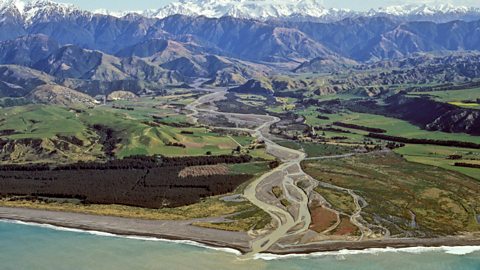
Deltas are found at the mouth of a river, as it enters a sea or lake. The sediments the river has been transporting by bed load(Also written as bedload.) The sediment carried by a river by being bounced or rolled along its bed. and suspended loadVery small and light sediment, usually fine clay and silt, transported by the river. are deposited as velocityThe speed of an object in a particular direction. decreases as the river flows into the sea. Deltas are usually made up of three types of deposit:
- The larger and heavier sediments are the first to be deposited as the river loses its energy. These form the topset beds.
- Medium-sized sediments travel little further before they are deposited, forming the foreset beds.
- The finest sediments travel furthest into the lake before deposition and form the bottomset beds.

More guides on this topic
- Coastal processes - Edexcel
- Coastal landforms - erosional and depositional processes - Edexcel
- Human activities on coastal management - Edexcel
- River processes - Edexcel
- Human management of rivers - Edexcel
- UK landscapes - Edexcel
- How do glacial processes form the land? - Edexcel
- Human activities and glaciation - Edexcel